Battle of Queenston Heights - October 1812
The Battle of Queenston Heights
Queenston Heights was researched and gamed in 2013.
This was my second War of 1812 battle having completed Crysler's Farm.
Researching Queenston Heights Terrain
Strictland Queenston C1790 Lithograph (from
Niagara on the Lake Museum web site)
A pre 1812 water colour of the Lower landing by Lady Simcoe
This is the map that I primarily used to transfer the terrain dimensions to the table top. Note the two layers of the east-west ridge line that extends from Queenston Heights to (cut by the Niagara River) Lewiston Heights on the American side.
Ref: french War of 1812 Web Site.
Fort Grey guns firing from the American shore above Lewiston down to Queenston.
Building the Terrain
White foam board carved with a hot wire to the dimensions of the aforementioned map. Used a dark blue felt as the river and laid the foam on top. The actual cliffs along the lower shoreline were about ten feet tall. At my scale of 1" = 20 yds the cliffs are a little bit taller but they look OK when compared with the heights.
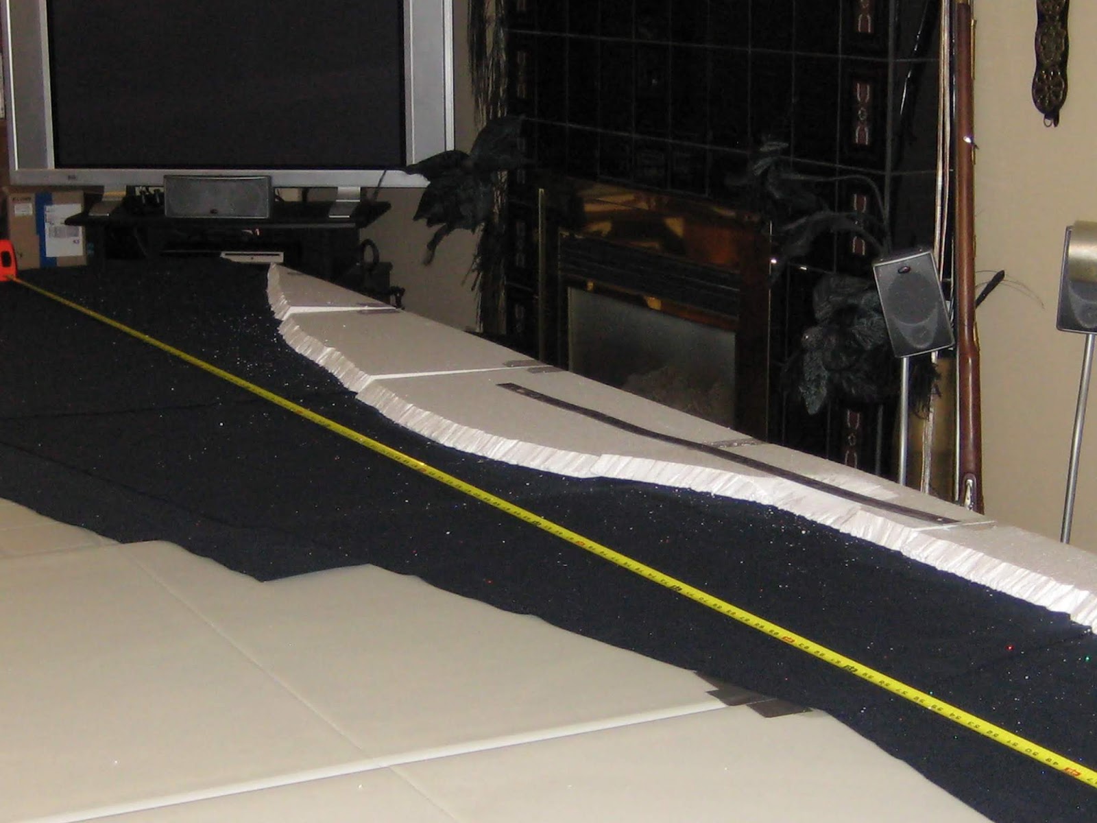
Checking the distances converted to inches ( I think I used 1" = 20 yds). The tape was main reference and I laid a steel rule at 90 degrees to it to measure the distances along the table edge.
Starting to add layers of foam for Queenston Heights (lower left).
A look at the blue felt on top of the folding tables, which will soon be covered with foam for the Canadian side.
A view looking north towards what will be Vrooman's Point. Note that most of the foam is covered with a canvas drop sheet, which has been painted in earthy/green colours.
Looking north again, the American shore on the right. The heights can be seen on the lower left. Note the road (brown) ascending the heights. Using paper to protect the blue felt as I add grit/sand and paint to the shore line.
In this view looking south (American shore on the left) you can get an appreciation of the rising ground that will have Fort Grey on the left and on the right part way up the British Redan.
Looking south along the Canadian shore and interior. Above the one inch foam base I think I used two additional layers of four inches each. You can discern the two main upper layers in the mid and upper photo areas. The layers form the east-west ridge line, which includes Queenston Heights. Note the brown slopes that denote the two rises of the ridge line.
The British Redan area and the road leading up to hieghts. Note the steep ravine (upper right center) that leads down to the Niagara River. It was from the this ravine that American troops were able to scale and ultimately surprise the British and Canadian troops.
A View of the Completed Queenston Heights Terrain with some troops on it.
This view gives a good idea of the steepness of the heights.
A view of both the embarkation (Lewiston dock ) and disembarkation (Queenston beach) operations.
American troops moving along the Canadian shore line to access the steep ravine.
It is crowded at the Lewiston dock as Americans embark boats to cross the Niagara.
American troops advancing upi the heights towards the redan while British regulars and Canadian militia contest their advance.
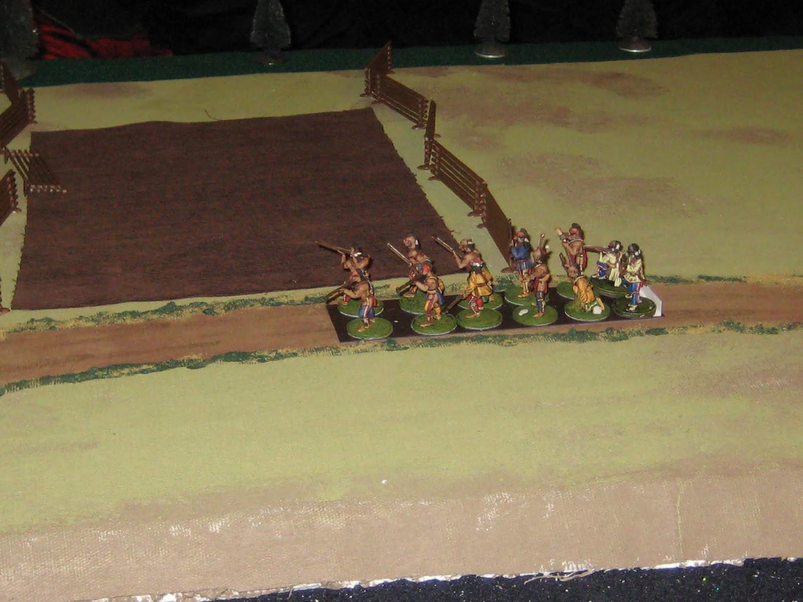
More Mohawks (mid left) moving towards Queenston and the Vrooman's Point battery firing on the American landing boats.
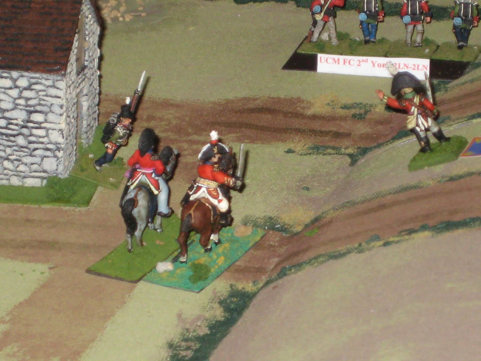
General Brock urging on the York Volunteers.
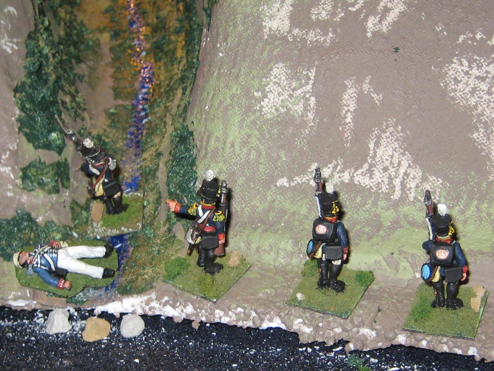
A view of American regulars making their way up the very steep ravine to gain the heights.
American NY militia has disembarked at the base of Queenston heights.
American light artillery at Lewiston give supporting fire to landing American troops.
British and Canadian troops defend Queenston near the first rise of the ridgeline (escarpment) . Note the York Road (mid left) that extends towards Burlington.
A British 9pdr garrison gun defends Queenston.
A view of American troops trying to besiege the British Redan, which has an 18 pounder. Note that there is a British company guarding the top of the ravine (upper left corner).
Americans crossing the Niagara from Lewistion (left) to Queenston (right). We used a d6 roll to determine where American boats landed to simulate the strong currents, which blew many boats towards Vroomna's Point.
Mohawk Natives moving along the ridge line to engage American troops that are scaling Queenston Heights. These Mohawks led by John Norton were instrumental in keeping American troops pinned in place until reinforcements arrived from Fort George and Chippewa.
The top of Queenston heights with Fort Grey ( upper center) on the American side.
Looking north, the village of Queenston.
Looking north Lewiston on the right and the ravine to Queenston heights mid left.
Looking south American shore on the left and the village of Queenston on the right.
The Hamilton residence on Hamilton Cove. It should be on the opposite side of the stream but there was not enough space in Queenston.


Brilliant! Beautiful terrain. An incredible terrain board.
ReplyDeleteThanks Mark. It took quite awhile to complete but was worth it at the time. I stated that it would be my last major terrain project, but then I did Lundy's Lane.
ReplyDelete